
The site has just been updated: reload the page to get everything working again.
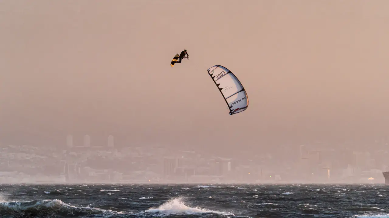
Crockett Lake / Whidbey Island kitesurf and wingfoil spot
United States · Washington
Overview
Crockett Lake is a shallow, brackish estuarine lake on the south shore of Whidbey Island, near Coupeville, Washington. A hidden gem for kitesurfers seeking perfectly flat water in moderate to strong winds.
The lake is separated from Admiralty Inlet by a narrow gravel bar (Keystone Spit). Wind blowing from the inlet crosses the spit and reaches the lake surface, creating glassy, smooth conditions ideal for tricks and freestyle. Water levels fluctuate with tides and seasonal rainfall, with the best riding typically from October to March when water levels rise.
The lake is very shallow throughout — riders can touch bottom almost everywhere but may get stuck in soft mud. Flat to slightly choppy conditions depending on wind strength. Water temperature around 14°C (57°F) in summer and 8°C (47°F) in winter — full wetsuit or drysuit required year-round.
Crockett Lake sits within Ebey's Landing National Historical Reserve and adjacent to the 423-acre Crockett Lake Wetland Preserve, an Important Birding Area (IBA) with over 230 bird species. Riders should be mindful of the ecological sensitivity of the area.
Spot forecast for Crockett Lake / Whidbey Island
Sunrise 16:38 · Sunset 03:12
Next tides
- Low tide · 1.6 m
- High tide · 3.6 m
- Low tide · 2.4 m
- High tide · 3.6 m
Forecasts provided by Open-Meteo
Crockett Lake / Whidbey Island: when to go?
Rideable days and hours computed for a minimum wind of 7 knots · log in to set your own (foil, twin-tip…)
98h
in March · 14.5 rideable days
The season runs from October to April, peaking in March: 11 rideable days a month and 98 hours of usable wind, at 10 °C. The low point is July, at 0.5 days.
Rideable days per month
Wind strength when it is rideable
When the spot works, wind sits mostly between 7 and 12 knots — 69% of rideable hours. Big-kite territory. The coldest month is January, at 6 °C. The wettest month is December, with 94 mm.
Monthly averages: Crockett Lake / Whidbey Island
| Month | Rideable days | Usable wind | Temperature | Rain |
|---|---|---|---|---|
| January | 10.5 | 54 h | 6 °C | 41 mm |
| February | 10.0 | 54 h | 8 °C | 47 mm |
| March | 14.5 | 98 h | 10 °C | 45 mm |
| April | 8.0 | 37 h | 14 °C | 26 mm |
| May | 4.0 | 27 h | 16 °C | 25 mm |
| June | 1.5 | 11 h | 19 °C | 16 mm |
| July | 0.5 | 4 h | 21 °C | 2 mm |
| August | 4.5 | 21 h | 22 °C | 29 mm |
| September | 3.0 | 18 h | 19 °C | 27 mm |
| October | 10.0 | 64 h | 14 °C | 65 mm |
| November | 11.0 | 60 h | 10 °C | 57 mm |
| December | 12.5 | 71 h | 8 °C | 94 mm |
Photo gallery of Crockett Lake / Whidbey Island
Ridden here? One photo or video, and the spot comes alive for everyone discovering it.
Technical details of Crockett Lake / Whidbey Island spot
The spot works with winds from SSE, S, SSW.
Spot functioning
Park on the south side of the lake along the road near Keystone Ferry Landing. Large grass area for rigging on the south shore.
Launch directly into the lake from the grassy shore. The entire lake is rideable but very shallow — expect to touch bottom regularly. Mud can be sticky, so avoid walking far from shore without your board.
Best sessions during October–March when water levels are higher (tidal influence and rainfall) and pre-frontal south winds are strongest. Check wind forecasts for southerly events.
Suitable for twin-tip riding, freestyle and tricks thanks to the flat water. Not recommended for foiling due to extreme shallowness.
Spot opening date · Required level
- Spot opening date
- Open all year round
Rideable all year round, but most commonly used from October to March during pre-frontal south wind events when water levels are highest.
Summer sessions are possible but wind is less reliable and water levels can drop significantly, exposing mudflats.
- Required level
- Intermediate
On the water
Very shallow brackish water throughout — rarely deeper than waist height. Bottom is soft mud that can trap your feet. Flat to slightly choppy surface depending on wind speed.
Water is a mix of fresh and salt water (estuarine), connected to Admiralty Inlet through a tidegate. Water levels fluctuate with tides and seasons — higher in winter, lower in summer when extensive mudflats may be exposed.
Parking
Get onto Whidbey Island (via Deception Pass Bridge from the north or Mukilteo–Clinton Ferry from the south). Take SR-525 and SR-20 toward Coupeville.
Main access: Take Poggensee Road off SR-525 and follow signs toward Keystone Ferry Landing. The lake is visible north of the road. Park directly next to the water on the south side — large grass area available for rigging.
Alternative: Fort Casey State Park parking lot near the ferry terminal (restrooms available). State Parks parking permit required ($10/day or Discovery Pass).
From the south on SR-20: turn right on Engle Road at the Coupeville stoplight, continue south 1.3 miles to reach the lake area.
Wind specificities
Crockett Lake works best with southerly winds. The dominant wind pattern comes from Admiralty Inlet to the south, crossing Keystone Spit and reaching the lake as smooth, laminar flow — creating the legendary flat water conditions.
South (S): primary wind direction, delivers the best flat water. Pre-frontal south winds during winter storms provide the strongest and most consistent sessions.
South-Southeast (SSE) and South-Southwest (SSW): also work well, wind still crosses the spit cleanly.
The lake is most commonly used during winter months (October–March) when strong pre-frontal south wind events coincide with higher water levels. Summer can be too calm.
The combination of moderate to strong wind with perfectly smooth water is exceptionally rare — described by local riders as potential world-class conditions for freestyle and tricks.
Hazards
Very shallow lake: mud bottom throughout. You can go from firm ground to knee-deep soft mud in a single step. Not suitable for foiling.
Row of old pilings crossing the lake at mid-point — be aware of their location, especially at higher water levels when they may be partially submerged.
Wildlife sensitivity: Crockett Lake is an Important Birding Area on the Pacific Flyway with 230+ bird species. The Whidbey Camano Land Trust manages the surrounding 423-acre preserve. Be respectful of wildlife, particularly during spring (April–May) and fall (July–October) shorebird migration periods.
Cold water: 8–14°C year-round. Full wetsuit (5mm) or drysuit essential.
Small lake: can get crowded quickly when conditions are good.
Something out of date? Suggest an edit
Live
KM7BEO COUPEVILLE4.2 kmsource noaa
Readings reserved for Premium members
Live readings from KM7BEO COUPEVILLE weather station are reserved for Premium members.
- Real-time readings
- Last 48 hours history
- Custom alerts
- Extended weather forecasts
Already a Premium member? Log in
Additional stations
-
Point Wilson6.8 km
Readings reserved for Premium members
source noaa
-
FW4667 Port Townsend8.1 km
Readings reserved for Premium members
source noaa
All the details of your session on windtracker.app
Webcams near Crockett Lake / Whidbey Island
Webcams provided by Windy.com
Nearby spots
All spots: Washington- 0 km Keystone / Whidbey IslandWashington, United States
- 5 km Ebeys Landing / Whidbey IslandWashington, United States
- 7 km Fort Flagler / Marrowstone IslandWashington, United States
- 9 km North Beach ParkWashington, United States
- 9 km Penn Cove / Whidbey IslandWashington, United States
- 12 km East Beach / Marrowstone IslandWashington, United States
Comments 0
No comments yet.