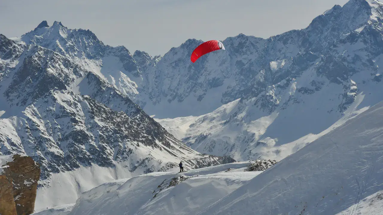
Renowned backcountry snowkite spot south of Grenoble, located on alpine pastures above the Laffrey lakes and Saint-Jean-de-Vaulx. Le Connest (or Connex) reaches 1609 m and offers a succession of domes and hollows ideal for snowkiting.
The site has two parts: the north section, accessible from the Clos de l'Oiseau after climbing from Les Arnauds, and the south section — the most interesting — featuring a wide ridge followed by a vast triangular flat area leading to the summit of La Peyrouse, with exceptional panoramic views over the southern Grenoble area.
Access: Laffrey → Saint-Jean-de-Vaulx → Les Arnauds (1170 m). Small parking just before the hamlet (5 spots max, do not park in the hamlet). Approximately 45 min hike following the snowy combe, keeping the forest on your right up to Clos de l'Oiseau. Kite launch after the trees at around 1500 m. The Chalet de l'As road (via Notre-Dame-de-Vaulx) is closed in winter (municipality blocks it with snowplow). In early/late season, this road may be accessible.
North wind: start from the valley near Hôtel des Dryades, large area to the east, northwest slopes for experienced riders.
South wind: start from the bend before the houses.
West wind: go around the beech grove at Clos de l'Oiseau to launch.
One of the finest natural viewpoints in the southern Grenoble area, considered one of the best local spots by regional snowkiters.
Premium weather models. Get the professional models (ECMWF, GFS, ICON, MeteoSwiss…) and a 16-day forecast. Without a subscription: Open-Meteo over 5 days.
The season runs from November to January, peaking in January: 6 rideable days a month and 102 hours of usable wind, at 3 °C.
The low point is February, at 0 days.
Rideable days per month
Wind strength when it is rideable
7-12 knots · 50%13-20 knots · 45%21-30 knots · 5%
When the spot works, wind sits mostly between 7 and 12 knots — 50% of rideable hours.
Big-kite territory.
The coldest month is January, at 1 °C. The wettest month is September, with 142 mm. Snow depth peaks in January, at 9 cm.
The spot works with winds from N, NNE, NE, SSE, S, SSW, W, WNW, NW, NNW.
RideableNot rideable
Local association recommendations
Onekite (Isère kitesurf, snowkite and powerkite association)
Spot functioning
North: main orientation. Start from the valley near Hôtel des Dryades, large area to the east, NW slopes for experienced riders. Watch for possible fog.
NE to NW: access via Les Arnauds recommended, half the distance compared to Chalet de l'As.
West: go around the beech grove at Clos de l'Oiseau to launch, then reach the north ridge.
South: usable but in strong gusty conditions, choose another spot. Start from the bend before the houses.
The south section (La Peyrouse) is well accessible by NE to W winds. Typical wind 15-25 knots.
Local association: Onekite (Isère kitesurf, snowkite and powerkite association).
Spot opening date
Spot opening date
Open all year round
Spot type
Freeride (Ski touring access)
Altitude
1,609 m
Parking
Small parking just before Les Arnauds hamlet (5 spots max). Do not park in the hamlet, respect the residents. You can also park at the last bend, 100 m before the hamlet. Chalet de l'As road is closed in winter (municipality blocks it with snowplow). In early/late season, access may be possible via Notre-Dame-de-Vaulx.
Wind specificities
North: main orientation. Start from the valley near Hôtel des Dryades, large area to the east, NW slopes for experienced riders. Watch for possible fog.
NE to NW: access via Les Arnauds recommended, half the distance compared to Chalet de l'As.
West: go around the beech grove at Clos de l'Oiseau to launch, then reach the north ridge.
South: usable but in strong gusty conditions, choose another spot. Start from the bend before the houses.
The south section (La Peyrouse) is well accessible by NE to W winds. Typical wind 15-25 knots.
Hazards
Cliffs on the edges of the plateau. Karst terrain with limestone pavements (lapiaz) sometimes hidden under snow. Risk of fog in north wind conditions. Steep slopes between the north and south sections. In strong gusty south wind, choose another spot. Access combe is steep and narrow. Very limited parking (5 spots), do not park in Les Arnauds hamlet. Access road blocked by municipality in winter.