
The site has just been updated: reload the page to get everything working again.
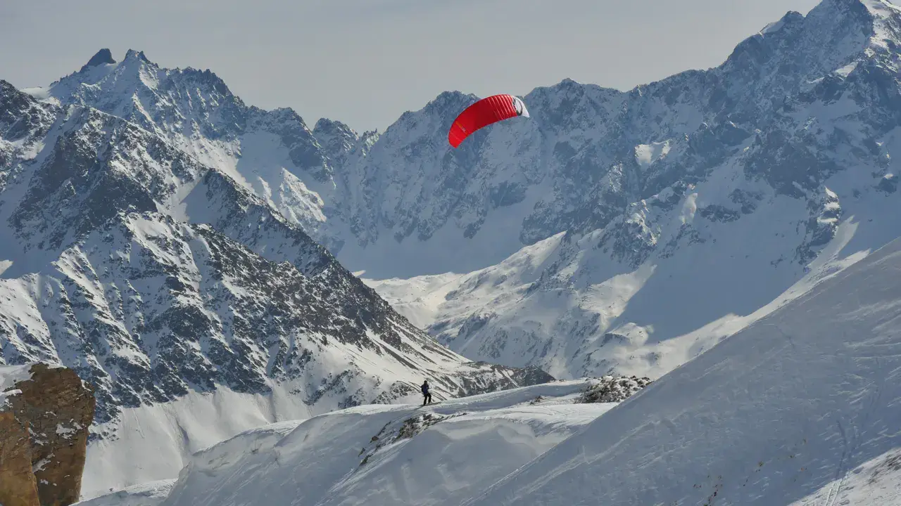
Col de la Madelaine snowkite spot
France · Auvergne-Rhône-Alpes
Overview
Col de la Madeleine (1993m) is one of France's most renowned snowkite spots, alongside Col du Lautaret and Petit Saint Bernard. Located in Savoie, it connects Tarentaise and Maurienne valleys, offering a 5.5 km opening between the Lauzière massif (west, 2829m) and Cheval Noir (east, 2832m).
The pass benefits from regular wind due to its altitude and position as a passage between two valleys. Stunning views of Mont Blanc from the summit.
Access via ski lifts from Valmorel or Saint-François-Longchamp (resorts connected at the pass).
Spot forecast for Col de la Madelaine
Sunrise 07:57 · Sunset 18:41
Forecasts provided by Open-Meteo
Col de la Madelaine: when to go?
Rideable days and hours computed for a minimum wind of 7 knots · log in to set your own (foil, twin-tip…)
144h
in January · 17 rideable days
The season runs from November to April, peaking in January: 14 rideable days a month and 144 hours of usable wind, at 2 °C. The low point is June, at 0 days.
Rideable days per month
Wind strength when it is rideable
When the spot works, wind sits mostly between 7 and 12 knots — 81% of rideable hours. Big-kite territory. The coldest month is January, at 0 °C. The wettest month is January, with 221 mm. Snow depth peaks in January, at 115 cm.
Monthly averages: Col de la Madelaine
| Month | Rideable days | Usable wind | Temperature | Rain |
|---|---|---|---|---|
| January | 17.0 | 144 h | 0 °C | 221 mm |
| February | 12.0 | 104 h | 1 °C | 69 mm |
| March | 15.5 | 140 h | 2 °C | 64 mm |
| April | 14.5 | 132 h | 6 °C | 96 mm |
| May | 6.0 | 47 h | 8 °C | 151 mm |
| June | 0.0 | 0 h | 15 °C | 110 mm |
| July | 0.0 | 0 h | 16 °C | 173 mm |
| August | 0.0 | 0 h | 17 °C | 119 mm |
| September | 0.0 | 0 h | 10 °C | 189 mm |
| October | 2.5 | 23 h | 8 °C | 178 mm |
| November | 9.0 | 61 h | 3 °C | 149 mm |
| December | 13.5 | 86 h | 1 °C | 134 mm |
Photo gallery of Col de la Madelaine
Ridden here? One photo or video, and the spot comes alive for everyone discovering it.
Technical details of Col de la Madelaine spot
The spot works with winds from N, NNE, NE, ENE, E, ESE, SE, SSE, S, SSW, SW, WSW, W, WNW, NW, NNW.
Spot functioning
The pass works as a wind corridor between the Lauzière and Cheval Noir massifs. Ideal position to catch airflow between Maurienne and Tarentaise.
Large alpine meadows at the summit allow great cruising and freeride sessions.
Spot opening date
- Spot opening date
- Open all year round
- Spot type
- Freeride (Ski touring access)
- Altitude
- 2,002 m
Parking
Access via Valmorel (Tarentaise side) or Saint-François-Longchamp (Maurienne side). Ski lifts can be used to reach the pass.
Road to the pass only open from late May to November (closed in winter).
Hazards
Altitude: 2000m, weather conditions can be severe.
Ski lifts: beware of cables and pylons near the ski area.
Terrain: check snow conditions and avalanche risk before venturing off marked areas.
Something out of date? Suggest an edit
Live
G2 Soleil Rouge2.2 kmsource Pioupiou
Readings reserved for Premium members
Readings from G2 Soleil Rouge weather station are reserved for Premium members.
- Real-time readings
- Last 48 hours history
- Custom alerts
- Extended weather forecasts
Already a Premium member? Log in
Additional stations
-
TSD BIOLLENE -Domaine Skiable Valmorel3.4 km
Readings reserved for Premium members
source Pioupiou
-
G2 Marquis3.2 km
Readings reserved for Premium members
source Pioupiou
All the details of your session on windtracker.app
Webcams near Col de la Madelaine
Webcams provided by Windy.com
Nearby spots
All spots: Auvergne-Rhône-Alpes- 32 km Dôme de VaugelazAuvergne-Rhône-Alpes, France
- 34 km MargeriazAuvergne-Rhône-Alpes, France
- 35 km Col du SabotAuvergne-Rhône-Alpes, France
- 40 km Col du Lac BlancAuvergne-Rhône-Alpes, France
- 42 km Plan des CavalesAuvergne-Rhône-Alpes, France
- 42 km Bout du lac - DoussardAuvergne-Rhône-Alpes, France
Comments 0
No comments yet.